


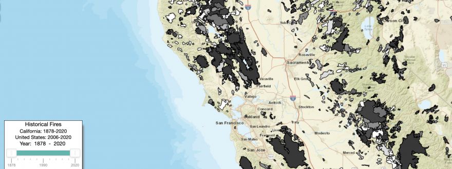
This particular map, just a small sampling of the greater work done by UCSD on this project, shows fire history throughout the United States. While we think about wildfire as cyclical and inevitable throughout our tinder-like West Coast landscape, this map shows us that, while fires are a regular occurrence, the frequency and spread of our wildfires have increased greatly in the last 10 years.
We recommend spending a few minutes with this map, zooming in on your hometown or familiar places in California, and interpreting this data for yourself. As we emerge from yet another devestating wildfire season, we hope you're taking the time to learn about preventative wildfire measures we can take as homeowners, renters, landscapers, eaters, and beyond. We'll continue chiming in on Thursdays with our weekly blog to touch on these topics and more, so stay tuned!
Video about WIFIRE's broad efforts enabling forecasting and data driven predictions
- The Barber Insurance Team